Why the Strait of Georgia?
The Strait of Georgia is part of the Salish Sea and is one of the most biologically productive marine ecosystems in the world, supporting a variety of important fishing and aquaculture industries. Aquatic life in the Strait takes advantage of the wide variety of marine habitats that are present, from the tidally exposed shallow mud-flats at the mouth of the Fraser River to regions where depths are more than 400 metres, and from the sheltered waters around the Gulf Islands and in the different mainland inlets to the open waters of the central Strait. However, this variety also causes problems for scientific investigations and marine policy, because marine conditions in different areas of the Strait may also differ greatly.
The variation of oceanographic conditions over space and time throughout the year has been mostly undescribed. Studying these conditions requires sampling covering many depth ranges at a high temporal resolution, which presents with a challenge due to the difficulties and cost of sustained field sampling in the ocean. This is especially true in the central and northern Strait, which are furthest from the various scientific and academic institutions that have traditionally studied this area.


About the Atlas
An issue of concern in this region is that Chinook, coho, and steelhead stocks, resident in the Salish Sea, have experienced tenfold declines in their survival during the marine phase of their lives, relative to conditions 30 years ago.
Between 2014-2019, the Salish Sea Marine Survival Project (SSMSP) developed a series of research hypotheses with the goal of understanding the reasons for these declines. The Citizen Science Oceanography Program (CSOP) was founded as part of SSMSP to research how changes in marine conditions affect these declines.
The CSOP was implemented in 2015, and in 2019 it underwent a transition into what is hoped to be a long-term monitoring program. This program engages trained volunteers with boats who collect oceanographic data in defined areas of the Strait of Georgia. All the data in the CSOP are archived and publicly available. We created this Atlas, updated annually, with the goal to provide the most up-to-date visualizations of oceanographic conditions in the Strait of Georgia and its various subregions.
For more information, view our story here.
The Citizen Science Oceanography Program
The Program starts with 10 patrols. In addition to patrols run directly by PSF, some data were acquired in the Ladysmith area by members of the Stz’uminus First Nation along with a trained technician, and in Cowichan Bay from an observational program run by Fisheries and Oceans Canada.
A new patrol begins in the Galiano region of the southern Strait. Several more stations were added offshore of the north arm of the Fraser to sample an inflowing mid-depth boundary current there.
The program begins publishing summaries of oceanographic conditions and harmful algae dynamics in the DFO State of the Pacific Ocean Reports.
The scope of the program was reduced to seven patrols: Powell River, Baynes Sound, Gulf, Sunshine Coast, Steveston, Irvine/Sechelt, and Galiano. The Sunshine Coast patrol in particular provided coverage in the central Strait that had previously been lacking.
The Atlas integrates Hakai Institute observational program’s data. This program regularly samples a number of stations in the far northern Strait. Also, incorporated biotoxin sampling as part of the sampling protocol.
The CSOP is endorsed by Global Harmful Algal Blooms program by Intergovernmental Oceanographic Commission of UNESCO.
Atlas of Oceanographic conditions in the Strait of Georgia first created by Rich Pawlowicz, Nicole Frederickson, and Svetlana Esenkulova.
Stations added in Burrard Inlet/Indian Arm, gathered by the Tsleil-Waututh Nation as part of their ocean monitoring activities.
Collaboration begins with the Snuneymuxw Nation to gather data on stations near Nanaimo.
Marked the final year of monitoring. Over these 10 years, the team conducted more than 1,400 vessel trips, collecting over 60,000 samples.
One-year extension funded by DFO’s Ocean Contribution Fund supports patrols in Baynes Sound, Gulf Islands, and Irvine’s Sechelt, adding an eDNA sampling component for biodiversity monitoring and species detection.
Field Sampling
The PSF Citizen Science Oceanography Program is currently composed of seven “patrols” (individual boats with associated sampling areas) geographically spread over the entire Strait. Each patrol consists of a vessel equipped with a downrigger “reel” providing the capability of lowering sampling equipment to 150 metres, technology for data downloading and transmission, sampling bottles, Secchi disks, filters, log sheets, and a team of two to five “citizen scientists”, who receive training in the use of the equipment. They all follow the same sampling protocol.
The patrols sample over 50 stations, about 20 times a year according to a predefined schedule, for a variety of oceanographic parameters. Sampling usually begins in March or April, and continues until October, at roughly two-week intervals. Sometimes, a single “winter” sampling date in January is scheduled in order to better understand conditions before the spring phytoplankton bloom. Patrols obtain conductivity-temperature-depth (CTD) probe measurements at all stations.
There are two types of stations: “Full” and “Busy”. “Full” stations sample phytoplankton, nutrients, secchi measurements, and conduct CTD casts. “Busy” stations include water sampling for nutrients (in duplicate), phytoplankton collections at the surface, 5m, 10m, and 20m, chlorophyll, secchi measurements, as well as CTD casts. The efforts in the field are backed up by several full-time technicians providing both “real-time” support and periodic in-person visits to all teams to monitor their activities and collect stored water samples, as well as a project manager and well over a dozen other lab analysts on a part-time basis, specializing in nutrient and chlorophyll analysis, plankton enumeration, CTD data processing and archiving, and quality control.
Click here for more information on the Citizen Science Oceanography program’s station and sampling plan.
Explore the Data
This Atlas uses the datasets from the CSOP to produce long term visual representations of oceanographic conditions in the Strait of Georgia (from 2015 to present). This Program visits over 50 sites in the Strait roughly 20 times a year to measure a variety of ocean properties, resulting in around 1000 stations sampled every year. Additional information in the Atlas comes from stations sampled by the Hakai Institue in the far northern Strait of Georgia, the Tsleil-Waututh Community Fishers program in the Burrard Inlet, and the Snuneymuxw Community Fishers programs in the Nanaimo area. This Atlas also incorporates data from the zooplankton archive of Fisheries and Oceans Canada and from the Washington State Department of Ecology.
Not included in the Atlas is information from Salish Sea surveys carried out 3 or 4 times a year by Fisheries and Oceans Canada scientists at the Institute of Ocean Sciences. These surveys consist of about 40 stations each in the Strait and provide information on water properties down to the bottom (i.e. at depths greater than the 150m limit for the CitSci program). Water column temperatures and salinities only, over all depths, have also been measured weekly since 1969 in the central Strait at the Canadian Forces Maritime Experimental and Test Ranges (CFMETR) in exercise area WG north of Nanaimo. That data are publicly available after the time of observation. Further information on surface water properties at daily time scales is available from systems installed by Ocean Networks Canada on vessels of the BC ferries fleet and from observers at some BC lighthouses.
HYDROGRAPHY
Standard hydrographic properties in the ocean, including water temperature, salinity, the dissolved oxygen content, total chlorophyll (as a proxy for the total amount of phytoplankton at depths where light can penetrate), and water clarity.
Hydrography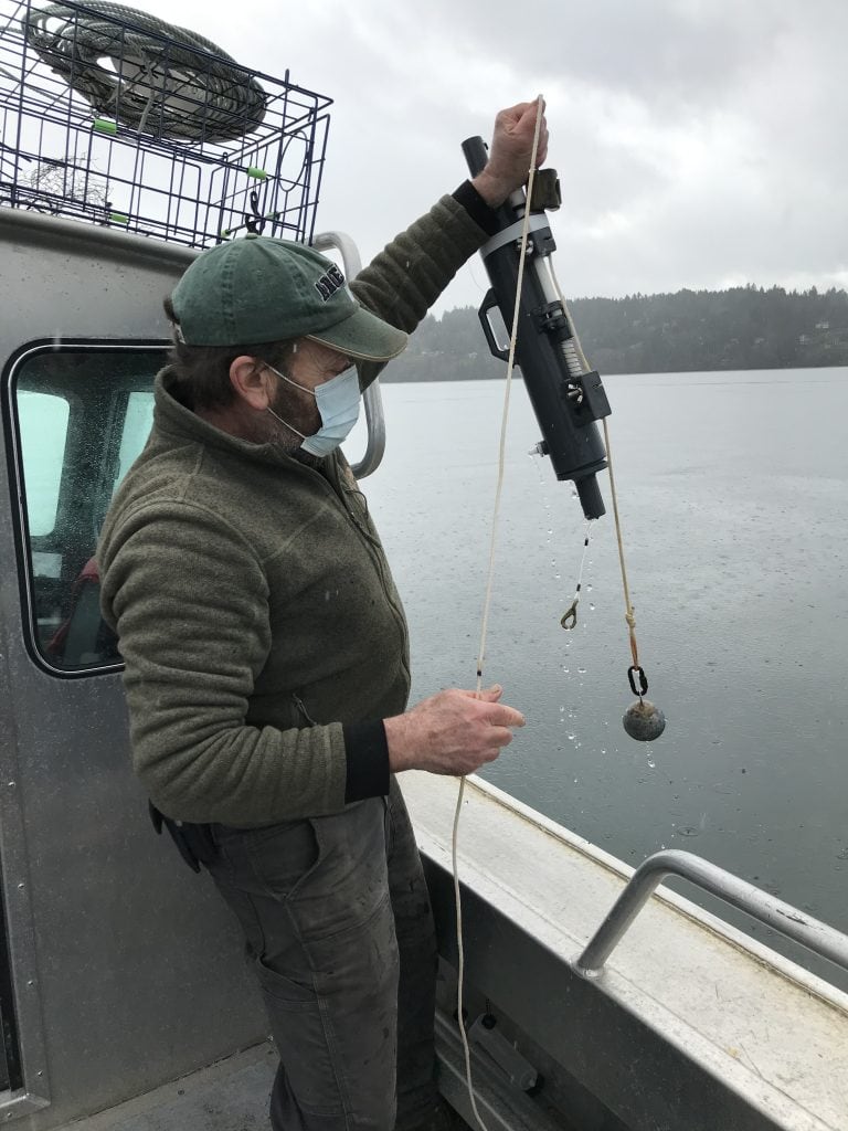
NUTRIENTS
Nutrient analysis water samples, collected at depths of 0m and 20m.
Nutrients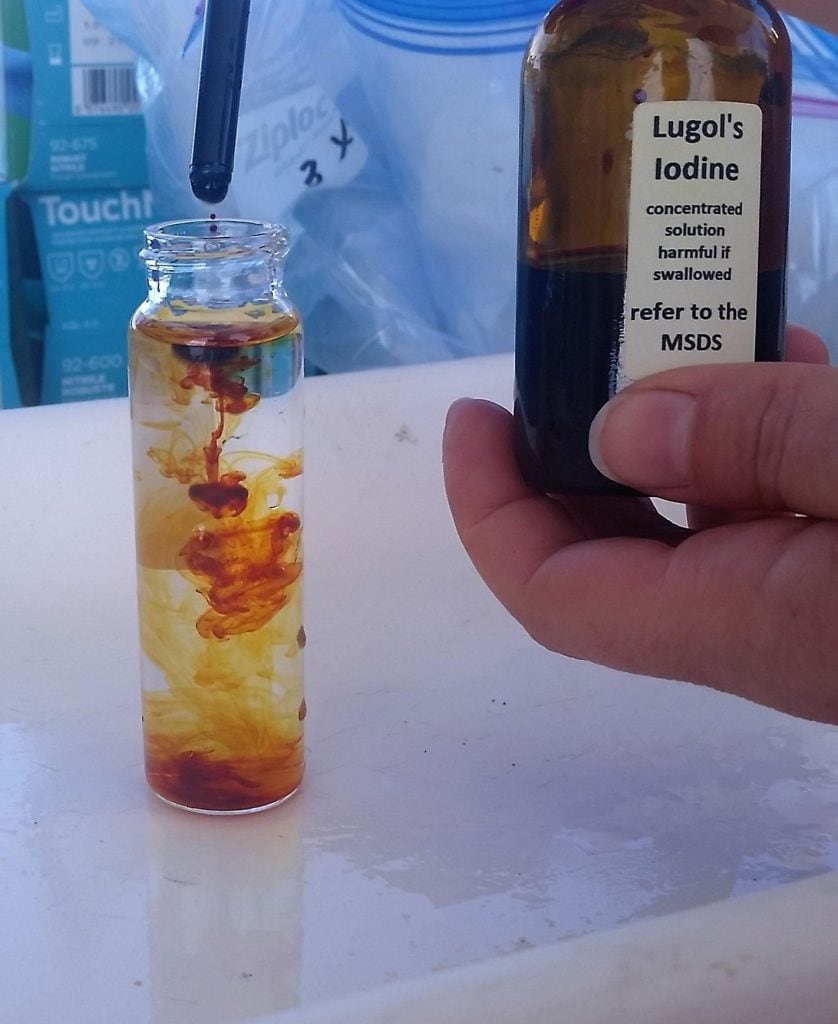
HARMFUL ALGAE
Surface seawater samples for phytoplankton analysis, collected with a Niskin bottle at depths of 5m, 10m, and 20m.
Harmful Algae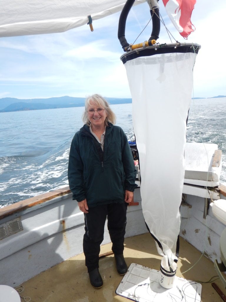
ZOOPLANKTON
Samples collected with a conical net, examined by a zooplankton taxonomist.
Zooplankton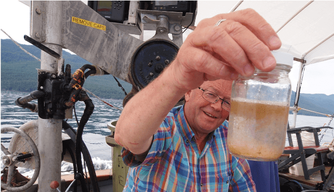
LEGACY ATLAS
Access to the original version of the atlas. This page, geared towards researchers, provides in-depth technical and scientific information, as well as access to all the figures.
Publications
- S. Esenkulova, K. Suchy, R. Pawlowicz, M. Costa, and I. Pearsall, 2021. Harmful Algae and Oceanographic Conditions in the Strait of Georgia, Canada, Based on Citizen Science Monitoring, Frontiers in Marine Science https://doi.org/10.3389/fmars.2021.725092
- S.W. Stevens, R. Pawlowicz, S.E. Allen, 2021. A study of the intermediate water circulation in the Strait of Georgia using tracer-based, Eulerian, and Lagrangian methods, Journal of Physical Oceanographyhttps://doi.org/10.1175/JPO-D-20-0225.1
- N. McEwan, R. Pawlowicz, E. Pakhomov, M. T. Maldonado, 2023, Seasonality of modelled planktonic food web structure in the Strait of Georgia, Canada, Ecological Modelling https://www.sciencedirect.com/science/article/abs/pii/S0304380023001333