RESILIENT COASTS FOR SALMON │ SPOTLIGHT COMMUNITIES
Oak Bay
Oak Bay is a coastal municipality located on the southern tip of Vancouver Island. The municipality is predominantly residential, with limited commercial areas and a high proportion of waterfront properties.
For the purposes of the Resilient Coasts for Salmon initiative, the study extent covers approximately 10.5 km² and includes about 14.7 km of marine shoreline along Haro Strait.
This area lies within the Traditional and Unceded Territory of the lək̓ʷəŋən (Lekwungen) speaking peoples, which includes the Songhees and Esquimalt First Nations.

Key Findings
Shoreline Modifications
Man-made structures like seawalls and riprap, often built to protect shoreline infrastructure, can actually exacerbate erosion by redirecting wave energy to nearby areas. These modifications also remove key intertidal habitats and food sources essential for the growth and survival of juvenile salmon and forage fish. By stripping away the natural complexity of coastal ecosystems, shoreline modifications reduce their capacity to support biodiversity and adapt to rising sea levels.
Length of modified vs. natural shoreline: The approximate length of Oak Bay that is modified as of 2022 is 7,609 m, with the remaining 7,121 m being natural shoreline, thus just over 50% of the shoreline was modified (Figure 7).
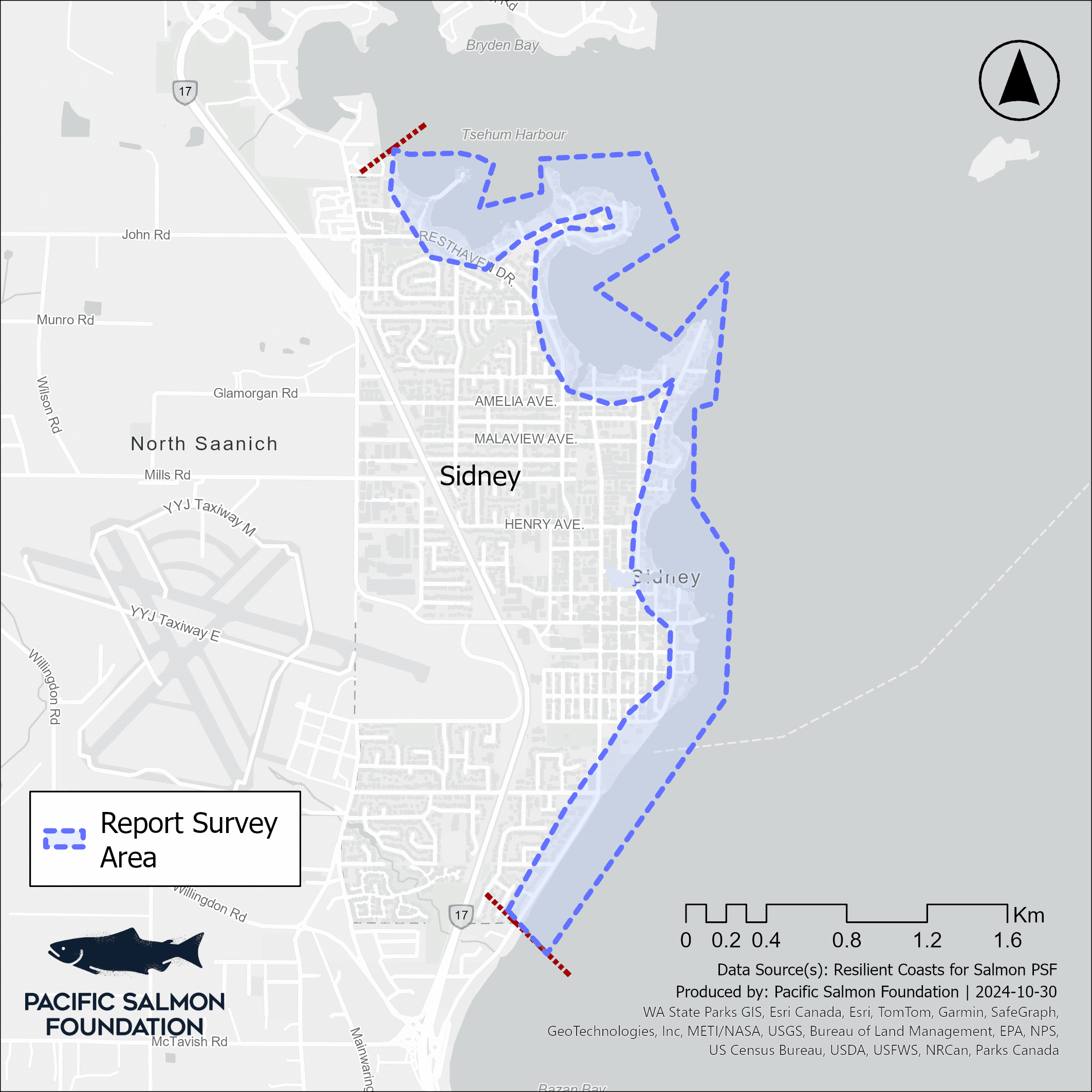
Figure 1. Coastal modifications (shown in blue) with the extent of data collection outlined by red dashes.
Length of shoreline by coastal modification type (e.g. Seawall): The most common modification types were seawalls/bulkheads (69.3%), riprap (17.1%), and modifications associated with marinas (6.9%) (see Figure 10 and Table 1 for all modification types).
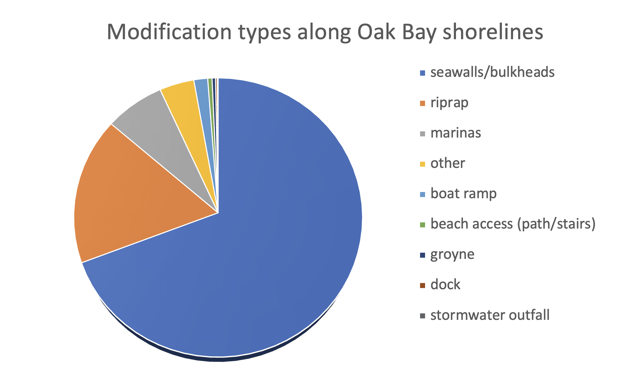
Figure 2. The percentage of modified shoreline by modification type.
Length of shoreline by coastal modification material (e.g. Concrete): The type of material most utilized for shoreline modification was concrete (43.8%), unknown material (33.0%), rock (12.0%), and masonry (11.0%) (see Table 2). The unknown/undefined category indicates that the recorder was not able to determine the material that was used, due to issues with image clarity or obstruction, or in cases when a mix of materials were used.
Table 1. The percentage of modifications, based on the type of material used in the modifications.
| Material | Percentage of Modifications |
| Concrete | 43.8 |
| Unknown/Undefined | 33.0 |
| Rock | 12.0 |
| Masonry | 11.0 |
| Wood | 0.2 |
Overwater Structures
Overwater structures, like docks and piers, cast heavy shade that degrades nearshore habitat. Juvenile salmon avoid these shaded areas, which alters their natural foraging and migration patterns by forcing them into deeper waters. There, they expend more energy and face greater predation risk. The reduced light also limits the growth of essential habitats like eelgrass and algae, along with the diverse communities they support.
Number of overwater structures total and by type (e.g. # of small marinas): Overall, the extent of overwater structures in Oak Bay is minimal, with six residential docks, and two large marinas. However, these marinas have the capacity to serve approximately 600 boats at any given time.
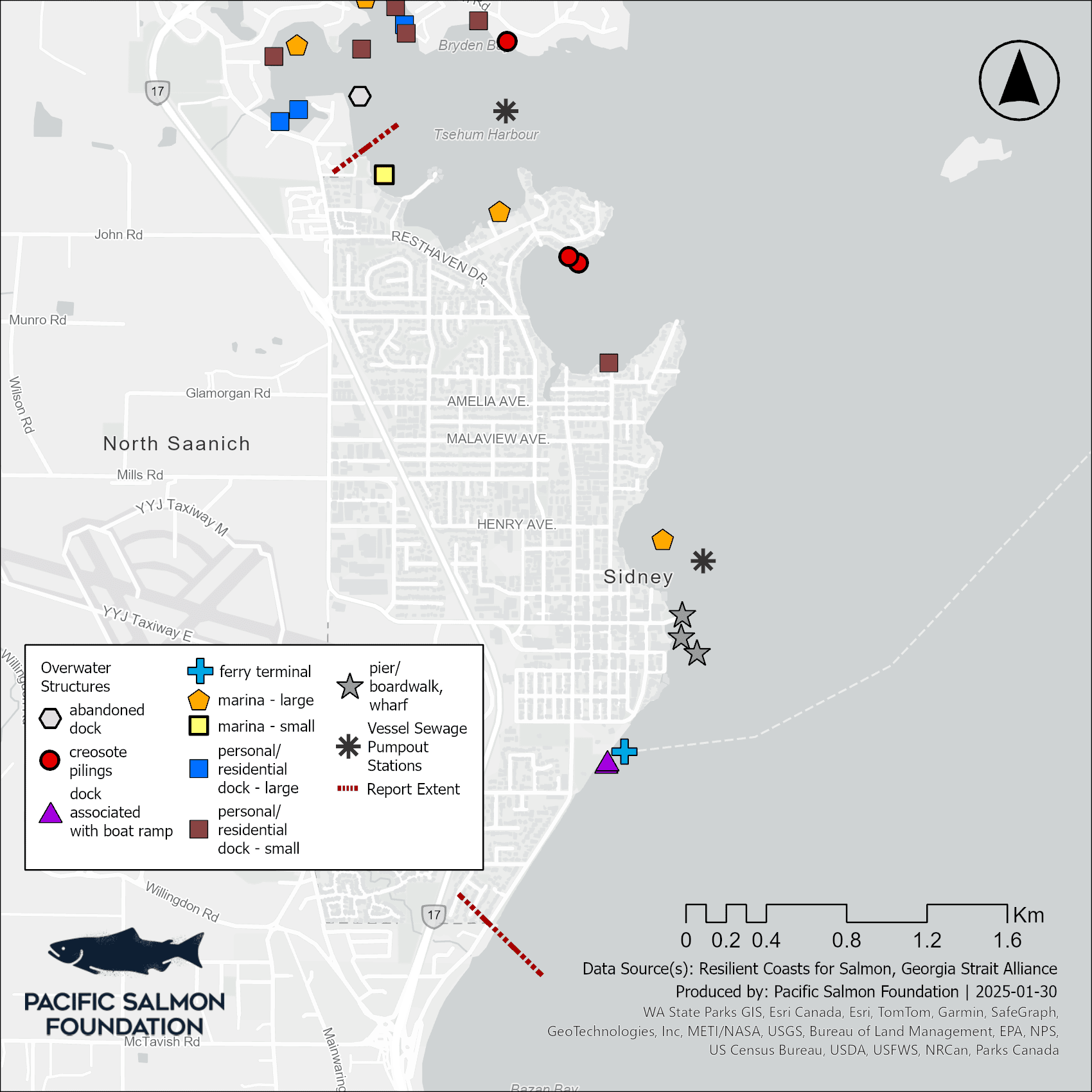
Figure 1. The extent of overwater structures within Oak Bay.
Log Accumulation
While logs are a natural part of coastal ecosystems, the escape of modified logs from log booms is leading to excessive accumulation. These logs can scour beaches, altering sediment composition and smothering nearshore vegetation.
Unlike natural logs, modified logs are stripped of root balls and branches, making them unstable and prone to rolling across critical habitats that juvenile salmon and forage fish rely on for growth, food, and shelter.
Length of shoreline where log accumulation was low, moderate, high, and extreme: Of the total shoreline, 6.6% (977 m) was found to have an extreme (>89%) accumulation of logs, with another 10% (1472 m) with high accumulations (50 to 89% coverage), and 10.8% (1584 m) having moderate levels (20% to 49%) of the beach covered by logs (Table 4). It should be noted that the moderate log accumulation category also represents a significant coverage of logs – whereby 20-49% log coverage on a given beach could negatively impact shoreline habitat.
Table 1. The length of shoreline (in percentage and metres) by category of log accumulation.
| Log Accumulation | Percentage of Shoreline | Metres |
| Extreme (>89%) | 6.6 | 977 |
| High (50 to 89%) | 10.0 | 1472 |
| Moderate (20 to 49%) | 10.8 | 1584 |
| Low/None (<20%) | 62.2 | 9157 |
| Unknown | 10.4 | 1541 |