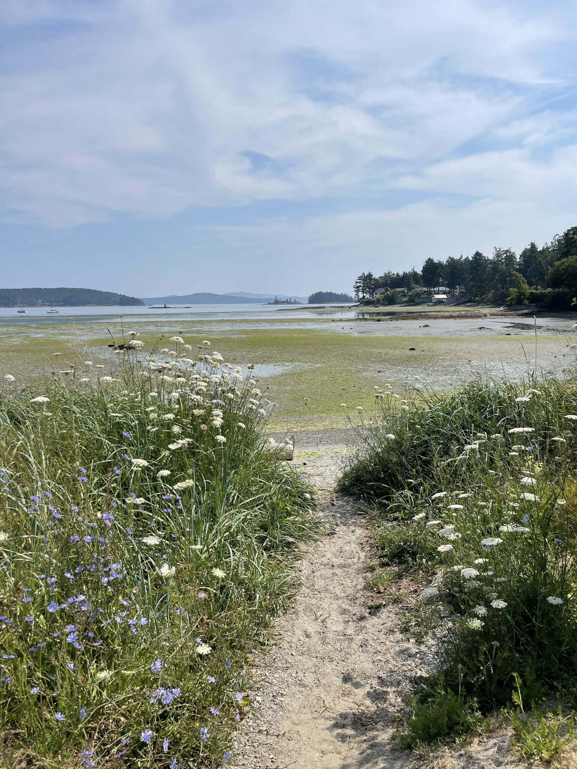
About the Shoreline Mapping Initiative
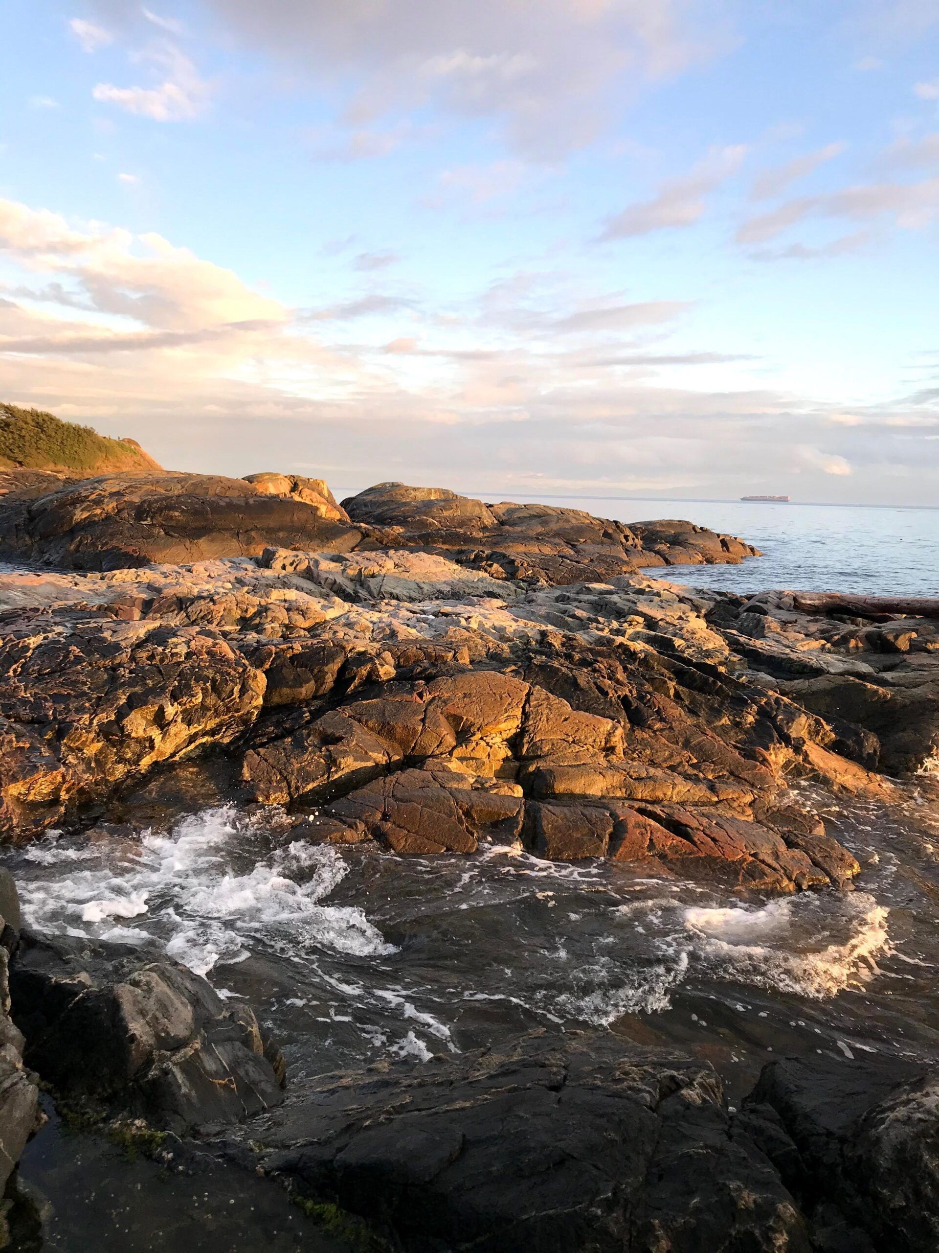
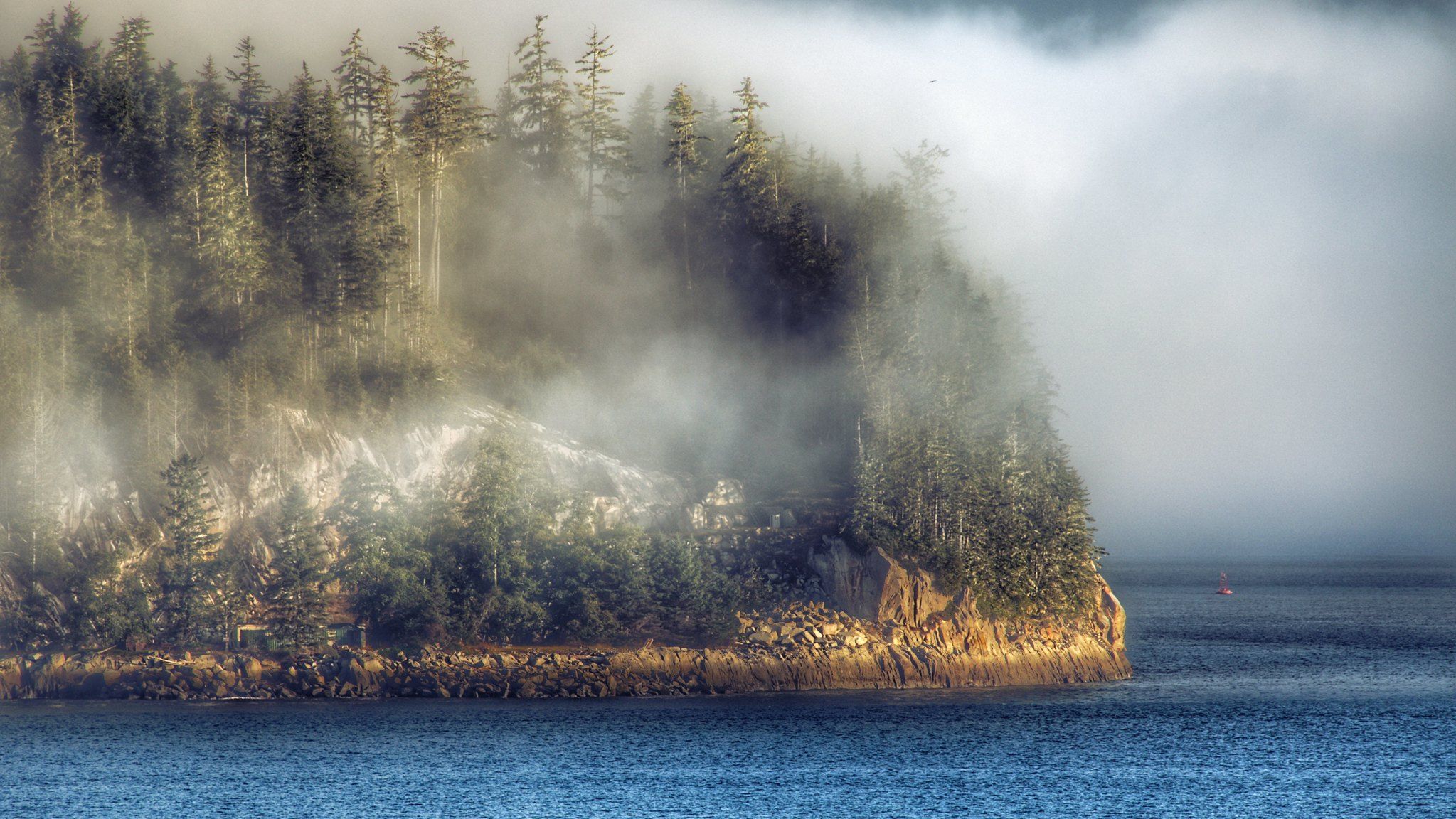
The Resilient Coasts for Salmon initiative has completed a five-year effort (2021 to 2026) to map shoreline features of concern along the eastern coast of Vancouver Island. These features include shoreline modifications (such as seawalls and riprap), overwater structures (including piers and docks), and log accumulation. Human-made structures and excessive log buildup can disrupt natural coastal processes, degrade habitat quality, and impact species that rely on nearshore environments, including Pacific salmon. Learn more about the effects of these features below.
The Shoreline Mapping Atlas serves as a central platform to support researchers, planners, and community members in making informed decisions to promote sustainable coastal development, healthy ecosystems, and resilient shorelines.
Shoreline Mapping Results:
- Explore Resilient Coasts for Salmon data layers, including Shoreline Modifications, Overwater Structures, and Log Accumulation.
- Overlay additional layers, such as forage fish spawning habitat and sensitivity to sea level rise, to analyze our data within a broader context.
- Download datasets for further research and decision-making.
Additional Components:
- Community Reports to view localized shoreline assessments from several communities on the East Coast of Vancouver Island.
- Coastal Adaptation Reports to learn about strategies employed at the local governments scale in the CRD and Islands Trust regions.
- Spotlight Communities to explore high-level results from other coastal communities.
Resilient Coasts for Salmon Layers:
As a part of our mapping initiative, we are focused on tracking three main feature types:
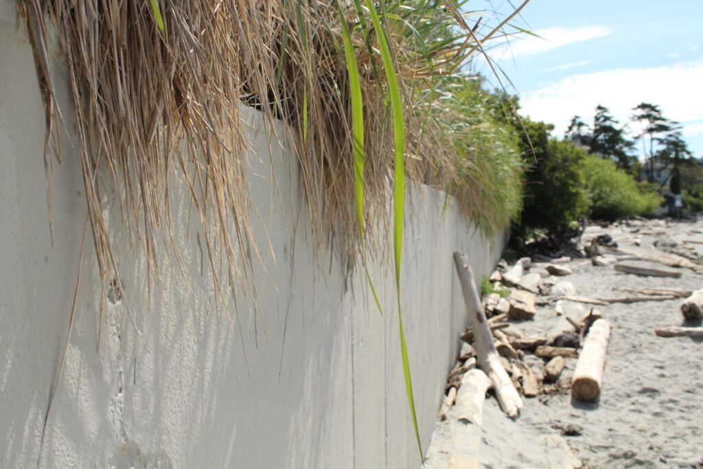
Shoreline Modifications
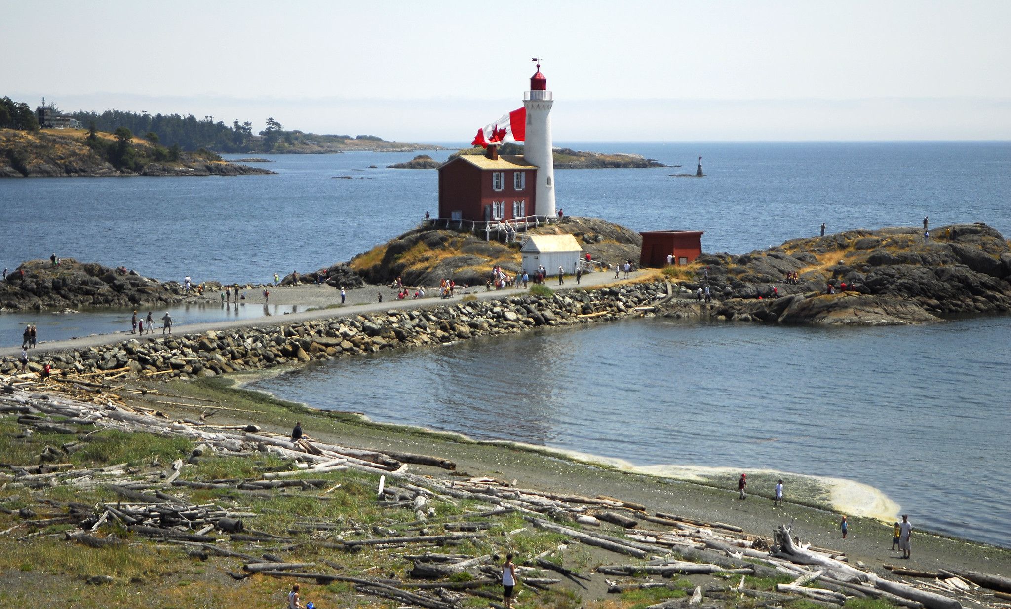
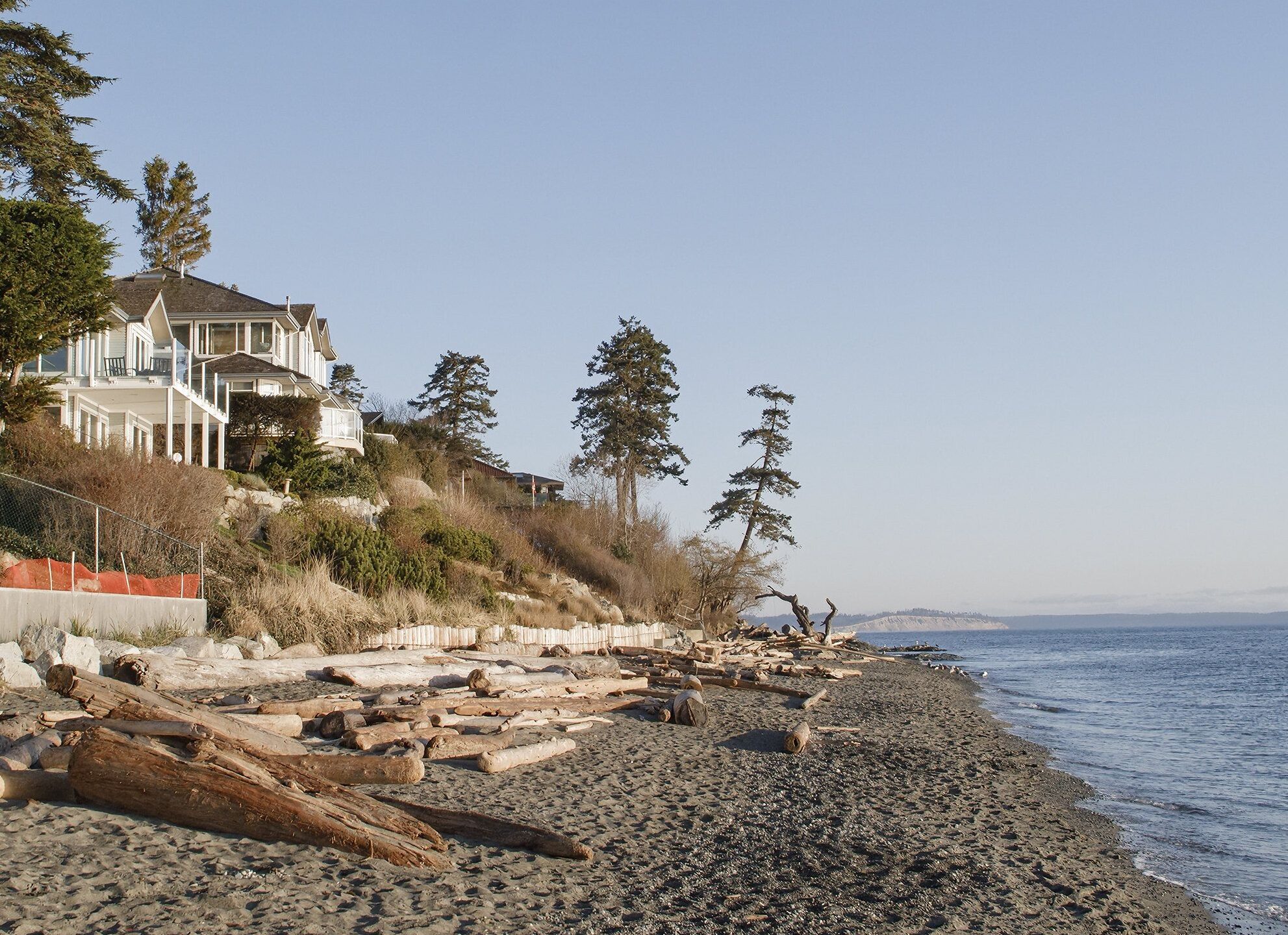
Man-made structures like seawalls and riprap, often built to protect shoreline infrastructure, can actually exacerbate erosion by redirecting wave energy to nearby areas. These modifications also remove key intertidal habitats and food sources essential for the growth and survival of juvenile salmon and forage fish. By stripping away the natural complexity of coastal ecosystems, shoreline modifications reduce their capacity to support biodiversity and adapt to rising sea levels.
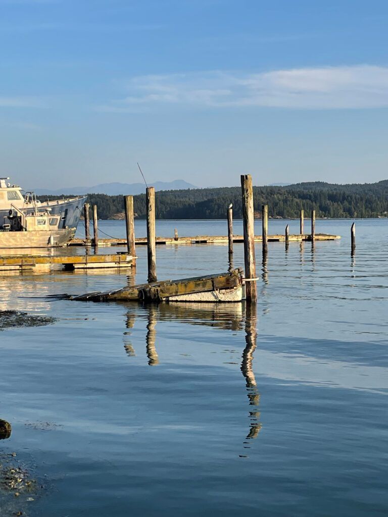
Overwater Structures
Overwater structures, like docks and piers, cast heavy shade that degrades nearshore habitat. Juvenile salmon avoid these shaded areas, which alters their natural foraging and migration patterns by forcing them into deeper waters. There, they expend more energy and face greater predation risk. The reduced light also limits the growth of essential habitats like eelgrass and algae, along with the diverse communities they support.
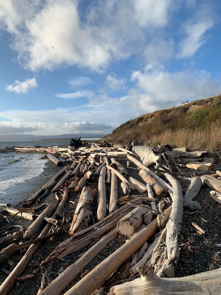
Log Accumulation
While logs are a natural part of coastal ecosystems, modified logs that escape from log booms can accumulate in excess, scouring beaches, altering sediment composition, and smothering nearshore vegetation. Unlike natural logs, modified logs are stripped of root balls and branches, making them unstable and prone to rolling across critical habitats that juvenile salmon and forage fish rely on for growth, food, and shelter.
To learn more about the impacts of shoreline modifications in the face of rising sea levels, check out our Climate Change Primer. To access and download the Resilient Coasts for Salmon layers, see below.
Explore Our Map
The map widgets in the sidebar can help you navigate the data and optimize your interactive experience. For additional guidance, please refer to our User Guide. We recommend using Google Chrome on a laptop or desktop for the best viewing experience.
 Home
Overview of widgets
Home
Overview of widgets
 Layers List
Toggle layer visibility
Layers List
Toggle layer visibility
 Legend
Reveal a key of layer symbols currently displayed
Legend
Reveal a key of layer symbols currently displayed
 Feature Info
View layer data attributes and values
Feature Info
View layer data attributes and values
 Shoreline Imagery
Access shoreline imagery dataset
Shoreline Imagery
Access shoreline imagery dataset
 Basemaps
Change the background of the map
Basemaps
Change the background of the map
 Share
Share or print the map
Share
Share or print the map
 Attribute Table
Explore the data table
Attribute Table
Explore the data table
This map showcases the shoreline imagery that was used to build the Resilient Coasts for Salmon data layers. We are committed to the respectful and appropriate use of this imagery. If you notice any images that you would like removed, please contact us at salmon@psf.ca. Your feedback is essential to the success of our mapping initiative. To share your thoughts, suggestions, and technical difficulties, please fill out our Feedback form.
Video Tutorial
To view our webinar, recorded on March 26, 2026, please visit the Pacific Salmon Foundation’s Youtube page. This webinar provides a walk through of the entire Atlas, including a tutorial for how to use the interactive map, as well as its accompanying pages within the Marine Data Portal.

Access the Data
Click the button below to access the Resilient Coasts for Salmon datasets in the Marine Data Portal. Here, you can download our data layers in various formats for your own use. You’ll also find our protocols, which outline how the data was digitized and include data dictionaries that define key terminology. We encourage you to stay in touch and let us know how you’re using the data!
To access datasets from external sources, click on a data point within the desired layer on the interactive map. Then, scroll down in the pop-up window to find the ‘Access Layer Data’ button.
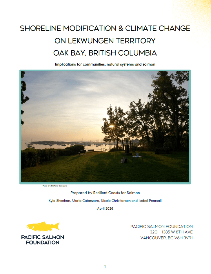
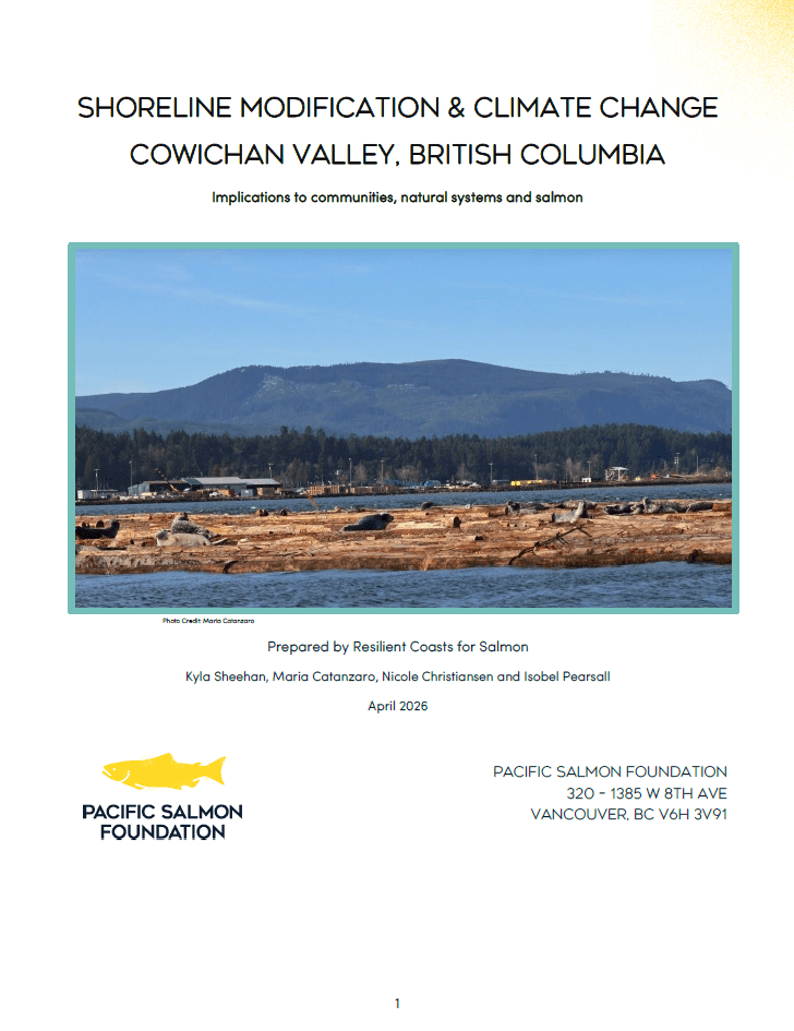
Community Reports
Click the squares below to explore reports for Oak Bay and the Cowichan Valley, each offering a localized assessment of shoreline alterations and log accumulation, along with recommendations for nature-based management. These reports are examples of how the data can be presented alongside relevant external data such as modeled forage fish habitat, shoreline sensitivity to sea level rise, and more.
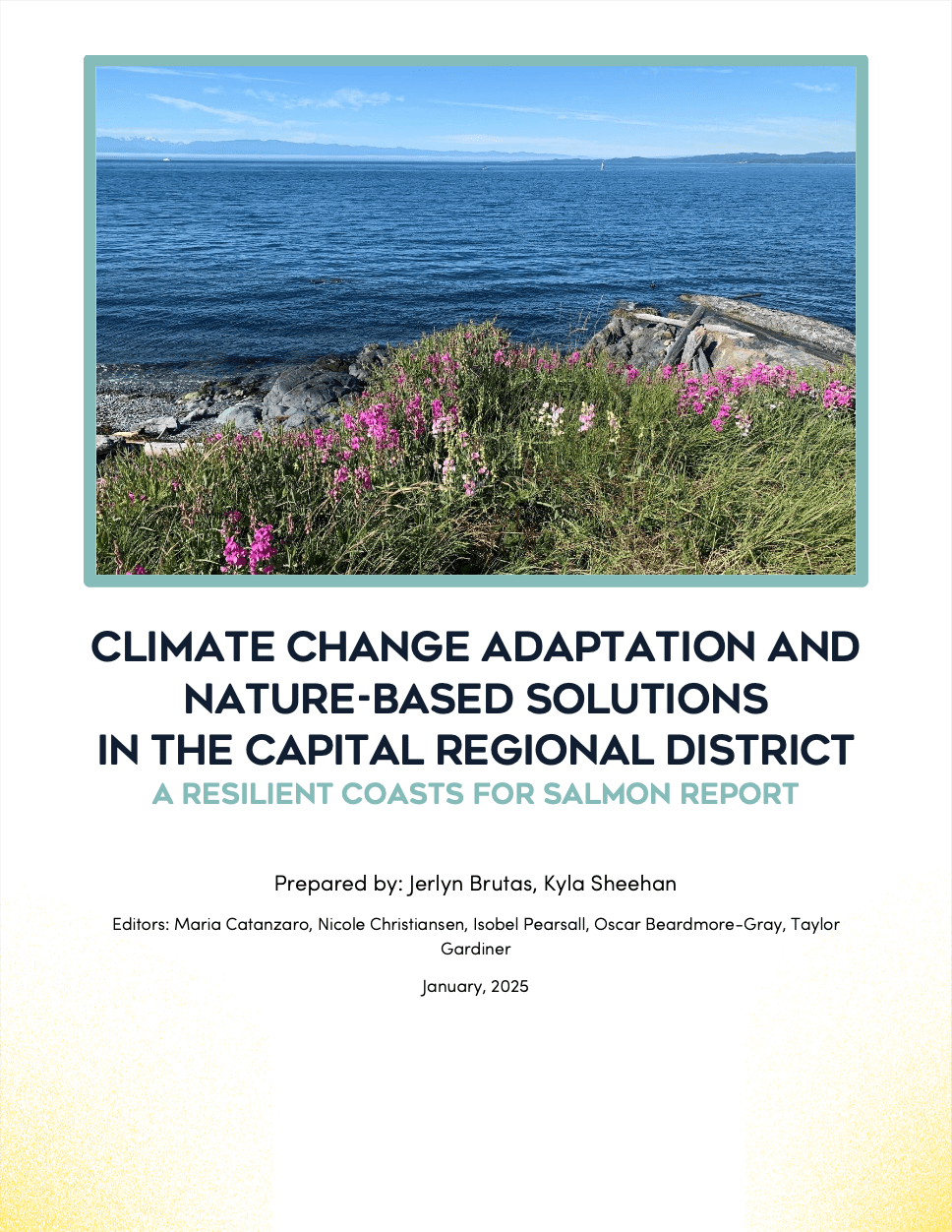
Coastal Adaptation Reports
Check out the reports below to learn about the coastal adaptation strategies in place across the Capital Regional District (CRD) and Islands Trust regions, along with the barriers these communities face in implementing nature-based approaches.

Spotlight Communities
For these communities, we did not create full reports, but you can click the squares below to explore high-level results, including the extent of coastal modification, and download static maps of Resilient Coasts for Salmon data.


Additional Resources / Future Recommendations / /
- MarineEcosystem Map: This is an interactive web-based data visualization platform, complete with over 450 layers of marine and coastal data for you to explore.
- Shore Zone: This initiative utilizes aerial surveys to inventory geomorphological and biological features of the shoreline. Shorezone data can be used to help inform community planning.
- State of Salmon: This platform is the culmination of many datasets coming together in an interactive graph which shows the per cent anomaly of current spawner or total abundance over the most recent generation compared to the long-term average for 9 regions within BC and the Yukon for 6 species of Pacific salmon.
- Pacific Salmon Explorer: Drawing on the best available data, this tool presents indicators of salmon abundance, catch, and productivity, as well as habitat pressure and condition, for over 400 biologically diverse groups of wild salmon – known as Conservation Units – across ten major salmon-bearing Regions
- 6PPDQ Toxicant Concentration map: This interactive map shows the sampling results for the tire-wear toxicant 6PPD-Quinone, led by the BC Conservation Foundation (BCCF) and Vancouver Island University (VIU).
- Newsletter: Shoreline modification impacts on salmon: In this newsletter from the Resilient Coasts for Salmon project, learn how the nearshore environment is actually critical habitat for Pacific salmon and forage fish, and how coastal modification features threaten those habitats.
- Newsletter: Resilient Coasts for Salmon Overview: Check out this Newsletter for a comprehensive overview of the Resilient Coasts for Salmon project, including our restoration demonstration sites, shoreline mapping initiative, Green Shores training, and our many educational resources.
- Climate Change Primer: Our educational primer, Impacts of Climate Change on Shorelines, People, and Salmon: Nature-Based Approaches for Ecosystem Health, provides an overview of climate-change impacts on the south and east coast of Vancouver Island, the impacts of hard armouring, the value of preserving natural shorelines, and how to use nature-based solutions as adaptation strategies for sea level rise.
- Tool Kit Articles: Our collection of ‘how-to’ articles provide tips and guidance on 25+ ways you can help improve conditions for salmon and all the habitats they rely on, for example:
- Field Guide to Shoreline Mapping: this resource was used at our community mapping workshops as a guide to tracking coastal modification features along the shoreline.
- The Climate Ready Infrastructure Service is a new free service offered by the Government of Canada to connect communities with climate experts to help inform and support projects related to addressing challenges associated with climate change.
- Check out the Stewardship Centre for British Columbia’s Green Shores programs. The Green Shores for Shoreline Development Credits and Ratings Guide can be used as a framework for implementing nature-based solutions in commercial, multi-family residential, subdivision, park, and institutional waterfront development areas.
- Sign up for Green Shores training to learn about the program’s guidelines and how nature-based solutions can provide shoreline benefits.
- Check out Northwest Straits Foundation‘s Shore Friendly program website for helpful articles and videos about shoreline restoration and coastal processes in the Salish Sea.
- Read the document: Rising Seas and Shifting Sands: Combining Natural and Grey Infrastructure to Protect Canada’s Eastern and Western Coastal Communities – Intact Centre on Climate Adaptation (intactcentreclimateadaptation.ca) to learn more about how communities can use hybrid designs.
Communities within the east coast of Vancouver Island face many challenges related to climate change including community safety, housing security, and loss of natural assets, and are limited in staff capacity and funding to take on nature-based projects to address these challenges. We appreciate the work that occurs within First Nations and municipal governments to care for these lands and waters, and would like to present the following as general recommendations for moving forward in the context of coastal adaptation:
- We strongly advocate that municipal/regional governments prioritize what is desired by local First Nations’ government and communities and allow these requests to guide next steps, including amendments to already established plans made. Ask local First Nations’ government what their capacity to engage is, what they require, and create space and time for this process. Follow engagement protocols chosen by each Nation, establish cultural safety, provide financial compensation for engagement as set by each Nation, set up agreements and/or memorandums of understanding if requested, and begin the process of educating oneself about historical and present day colonialism on Southern Vancouver Island and beyond. The following recommended management strategies are not meant to negate the positive work that the local government has done or is currently working towards. We appreciate that many local governments have taken significant steps in working respectfully with First Nations towards effective coastal adaptation. Please consider this list of recommendations a starting point in working to build coastal resilience for people and habitat.
- Collect and model comprehensive datasets for flood inundation and sea level rise modeling that include site investigations, coastal engineering analysis, alongside coastal geomorphologists and geologists.
- Collect additional data and submit to the Vital Signs data portal, including drift cells in functional condition, extent of forest cover in nearshore marine riparian areas, feeder bluffs in functional condition, areas of sediment accretion and erosion, and miles of intertidal beach in functional condition.
- Official Community Plans (OCP) can help guide decision making at a local level by addressing the following:
- Consider introducing coastal development policies with a Shoreline Development Permit Area (DPA), to protect the integrity of the shoreline, further manage or limit coastal development, and protect existing development from the impacts of coastal climate change. This includes strengthening what constitutes an exemption and ensures compliance.
- Expand the Shoreline Management plans in the OCP, with financially compensated consultation with local First Nations, to strengthen erosion monitoring (which can include indicators chosen by the Nations), to move towards a non-contingency fund to support the longevity of shoreline health, and towards planning for continued, foreseeable changes on shorelines.
- Incorporate strong sensitivity to sea level rise models into community adaptation plans; consulting models before any development permits are accepted.
- Hire coastal geomorphologists, coastal engineers, and biologists to provide expert consultation to review and provide expert guidance for approvals for shoreline development permits and design plans. Ensure that individuals responsible for issuing permit approvals have readily available access to these experts. Ensure that all Qualified Environmental Professionals (QEP) and Registered Landscape Architects hired under the DPA to supervise or provide recommendations for development plans, are: highly knowledgeable about natural coastal processes and hydrology, and include the following in their process: site specific coastal processes modelling, historical change assessments including historical knowledge, observed and future erosion potential, recommending setbacks to accommodate erosion when possible, assessments to drastically reduce project footprint and potential habitat degradation, requiring landowners to monitor the project into the future (designed by experts), and following up with monitoring requirements.
- Strengthen the OCP to minimize further hard armouring and shoreline development
- Create bylaws and policies whereby seawalls/bulkheads are a last resort. Some communities have done so by requiring that it be proven that hard armouring is the only viable option before proceeding with building a new structure or replacing/repairing an existing structure.
- Require strict ecological assessments to prevent loss of habitat, including shellfish habitat that can become buried.
- Recommend stricter conditions for development permits that address bank instability and the identification of areas that cannot be developed except what is permitted in the conditions.
- Introduce laws for larger setbacks. Prohibit new builds along the coastline within a specific setback so that parks and natural areas have the ability to adjust with rising sea levels. Require adequate consultation with professionals like coastal geomorphologists.
- Remove unnecessary armouring on public lands, such as parks, with proper assessment by coastal professionals.
- Taking a precautionary approach to potential habitat degradation and habitat disruptions.
- Refer to other jurisdictions that have included Green Shores measures in their Official Community Plans (e.g., District of Central Saanich).
- Focus on bio-cultural indicators of well-being as expressed by First Nations’ community members, First Nations’ governments, and general community members. This may include physical, mental and spiritual health, ability to access safe foods, ability to practice traditions and ways of life that support holistic well-being, and much more. This can help guide restoration priorities and areas that require protection from future degradation and development.
- Protect and restore connectivity between the upland and shoreline where possible; and support soft shore approaches (nature-based approaches) for climate change impacts such as erosion, as well as critical habitat. If redevelopment in coastal areas occurs, include restoration requirements on the foreshore that protect natural coastal processes and habitat.
- Consider upgrading stormwater infrastructure and incorporating Green Infrastructure (GI) such as rain gardens in areas that have high levels of impervious surfaces to reduce runoff into the marine environment.
- Address, control and rectify contaminants and pollution, including sanitary waste control, to work towards safe access to traditional foods and a healthy ecosystem.
- Introduce stricter policies to greatly restrict or prohibit tree removal and other riparian vegetation within a specific setback distance along the shoreline.
- Create a Natural Asset Inventory and Management Plan to understand the community’s resources and how to protect them.
- Develop a strategy to reduce habitat degradation and fragmentation by boat moorings. Traditional moorings, which consist of heavy chains and anchors, drag and scour the seafloor as the tide ebbs and flows. Anchoring can scour and damage eelgrass, resulting in a reduction in the density and extent of eelgrass and creating fragmented habitat. It also suspends sediment in the water column that can smother eelgrass, reducing its ability to thrive and receive light.
- Damage to eelgrass can be avoided by anchoring in depths beyond 7m.
- Environmentally- friendly moorings contain a mid-line float that holds a rope above the seafloor – it will not scour or damage eelgrass. See here for more information.
- Explore opportunities to install Voluntary No Anchor Buoys in your community.
- Reduce impacts of overwater structures:
- Pursue and/support marinas that want to pursue eco-certification through the Strait of Georgia Alliance’s Clean Marine BC program.
- Encourage the building of salmon-friendly docks when docks are necessary, and the sharing of docks amongst neighbours when possible.
- Create and/or promote climate action incentives for community members to:
- reduce erosion on properties by incentivizing the installation of proper drainage by professionals;
- plant marine riparian vegetation with emphasis on native species;
- use nature-based soft shore restoration instead of hard armouring;
- restore riparian vegetation in locations where seawalls are necessary;
- consider managed retreat where possible;
- remove seawalls when the site and conditions are appropriate as deemed by qualified professionals; and
- apply nature-based solutions around the home, including reducing impermeable paving, discouraging the use of pesticides and fertilizers, encouraging the use of less harmful cleaning supplies or by making them, manage stormwater runoff and incorporate raingardens to help filter pollutants before it can enter waterways, and encouraging rainwater harvesting and not watering lawns during the summer months.
- Provide ongoing environmental training by professionals (local climate change specialists, biologists, coastal geomorphologists, coastal engineers) for government staff
- Provide training opportunities for local planners and other staff to understand current climate change risks and impacts, and restoration strategies that utilize a nature-based approach. The Green Shores® training program is a great place to start.
- Reduce log accumulation on beaches through log salvage. Log salvaging can be a great way to remove unwanted logs from a beach and protect forage fish habitat. Anyone looking to salvage logs from the shore must obtain a valid provincial permit. Western Log Sort and Salvage is a licensed buyer of marine salvage logs in the Vancouver/Vancouver Island region – helping drift logs return to the market, reducing the impacts to marine vessels and the environment. Learn more at Marine Log Salvage – Province of British Columbia.
")
The Mapping Initiative Team
Meet the team of dedicated individuals that are responsible for making this project possible. Click here to learn about other individuals who played key roles in different aspects of the Resilient Coasts for Salmon initiative.

Kyla Sheehan
Project Manager
As the project manager, Kyla has been leading the development of the mapping initiative from start to finish.
She led community outreach efforts, traveling to communities throughout the East Coast of Vancouver Island to share our educational resources and discuss the findings of the shoreline mapping initiative and its implications for coastal adaptation. Kyla played a hands-on role in the data digitization process, ground-truthing shorelines, analyzing imagery, and recording data to build the Resilient Coasts for Salmon data layers. Additionally, Kyla is one of two head writers on the Community Reports.

Maria Catanzaro
Projects Coordinator
Maria has been at the heart of the Resilient Coasts for Salmon initiative since its inception, bringing her meticulous attention to detail and extensive knowledge of nearshore habitats to drive the project forward.
She has played a key role in developing digitization protocols, analyzing shoreline imagery, and mapping coastal modification features that form the Resilient Coasts for Salmon data layers. Maria has also co-authored numerous educational resources, including Tool Kit articles and the Climate Change Primer, and has contributed as a lead author of the Community Reports.

Isobel Pearsall
Former Director, PSF Marine Science Program
Dr. Pearsall is the former Director of the Marine Science Program for the Pacific Salmon Foundation.
She developed the idea for the Resilient Coasts for Salmon initiative and authored the original proposal that secured funding from Environment and Climate Change Canada through the Climate Action and Awareness Fund. From 2021 to 2024, Dr. Pearsall provided oversight, guidance, and creative direction for the project. Thank you, Isobel, for making the Resilient Coasts for Salmon initiative possible.

Ben Skinner
GIS Specialist
As the Geographic Information Systems (GIS) Specialist at the Pacific Salmon Foundation, Ben has brought his extensive experience in spatial analysis and data management to the Resilient Coasts for Salmon initiative since its initial launch.
He has been instrumental in transforming Resilient Coasts for Salmon data into visually engaging static maps and informative analyses through GIS platforms and FME. These results feed directly into the Community Reports, providing actionable insights that will guide future efforts to build resilient shorelines and protect nearshore habitats.

Mitch Miller
Videographer and Vessel Captain
Mitch expertly navigated a 16-ft research vessel called Wilbur along over 500 km of rugged coastline from Victoria to Port McNeill. He coordinated the collection of high-resolution and 360° imagery using two professional-grade cameras. In areas where Wilbur couldn’t safely approach, he captained a small tender to maximize coverage of the shoreline. This extensive imagery dataset became the backbone of the Resilient Coasts for Salmon data layers, making the Mapping Initiative possible. Mitch also provided his videography and directorial skills in the creation of our Native Plant Nursery Tour, Shoreline Slope Restoration Project, Shoreline Mapping Initiative outreach videos, as well as our upcoming documentary on the restoration at Dyke Road Park in Comox, B.C.

Taylor Gardiner
Research Assistant
Taylor joined the Resilient Coasts team in 2025 as an intern while studying Marine Biology and Ocean Sciences at the University of Victoria.
During her 9 months as part of the project team, Taylor was responsible for creating the Resilient Coasts for Salmon Atlas page and Interactive Map. The creation of this platform involved transforming and finessing the geospatial data, troubleshooting data storage considerations, adding user-friendly features, and creating engaging pages where the reports and results can be accessed easily by a wide audience. Taylor also assisted in creating the Marine Data Portal pages, where the data can be downloaded.

Natalia Garcia-Arias
Software Implementation Technician
Natalia joined the Resilient Coasts team in 2025 to support with the analysis of statistics presented within the Community Reports. Using a software platform called FME, she streamlined and refined workflows, accelerating the delivery of community-level analyses.
She first joined the Marine Data Centre as a co-op student studying Computer Science at the University of British Columbia. Before her involvement with the Mapping Initiative, Natalia applied her expertise to support data management and build a variety of other atlases, maps, and dashboards within the Data Centre.

Jerlyn Brutas
Research Assistant
Jerlyn joined the Resilient Coasts team in 2024 as a co-op student studying Applied Animal Biology at the University of British Columbia.
During her 8 months on the project team, Jerlyn produced two comprehensive Coastal Adaptation Reports detailing the coastal adaptation strategies and barriers to nature-based adaptation at the local government level. Jerlyn conducted interviews with local government staff and poured over documents such as Official Community Plans for both the Capital Regional District and the Islands Trust region. Jerlyn also represented the team in a webinar hosted by the Real Estate Institute of BC, as well as a presentation at the 2024 Pacific Estuarine Research Symposium.

Sophie Weissfloch
Research Assistant
Sophie joined the Resilient Coasts team in 2023 as a co-op student studying Quantitative Environmental Sciences and Math/Computer Science at the American University of Paris.
During her 4-month term, she initiated the digitization of overwater structures and log accumulation data, carefully analyzing high-resolution imagery to create digitized features in QGIS. Sophie also contributed to developing the methods used to digitize and describe these features, as detailed in the protocol document. She also helped to collect shoreline imagery on foot and by kayak in areas where Wilbur could not get close enough to shore.

Nicole Christiansen
Programs Coordinator, PSF Marine Science Program
As Programs Coordinator for PSF’s Marine Science Program, Nicole brings a diverse background in marine, estuary, and freshwater ecosystems to her work supporting the Resilient Coasts for Salmon initiative and the broader portfolio of Marine Science projects.
From 2021 to 2024, she contributed to building and maintaining the Resilient Coasts for Salmon website, creating printed resources, and writing and editing educational materials, including the Climate Change Primer. She also participated in key outreach events and workshops.

Paulina Salinas Ruiz
Data Integration Specialist
In her role as Data Integration Specialist at the Marine Data Centre, Paulina helps connect data infrastructure with the Resilient Coasts for Salmon initiative.
Paulina has played a key role in developing and refining the Marine Data Portal pages where the Resilient Coasts for Salmon data can be downloaded publicly. She has also contributed behind the scenes by offering technical support and expertise during the creation of the Interactive Map.

Terry Curran
Geospatial Consultant
As the Geospatial Consultant at the Pacific Salmon Foundation, Terry has brought his valuable knowledge of geospatial data management to the Resilient Coasts for Salmon initiative.
He played a key role in managing the project’s extensive shoreline imagery collection, transferring over 30,000 images to a remote server where the imagery is publicly yet securely available. Terry’s efforts have enabled fast, efficient access to imagery displayed within the Interactive Map.

Wilbur
Research Vessel
Wilbur may be small, but this 16-ft research boat played a big part in the Resilient Coasts for Salmon Mapping Initiative!
Captained by Mitch Miller, Wilbur cruised along the shoreline from Victoria to Port McNeill, capturing imagery. Outfitted with two cameras, Wilbur recorded both 360° and high-resolution images, all linked to the boat’s GPS. In areas where Wilbur couldn’t navigate close to shore, imagery was collected by tender, kayak, or on foot.
With over 500 km traveled and 60,000 high-resolution images collected, Wilbur’s contributions were instrumental in building the dataset to support resilient shorelines.
Funders & Collaborators
Resilient Coasts for Salmon is a collaborative initiative led by the Pacific Salmon Foundation with contributors such as the Stewardship Centre for British Columbia, World Wildlife Fund – Canada, Peninsula Streams and Shorelines, and many others. Resilient Coasts for Salmon is funded in part by the Government of Canada.